Digitising the film set with drones

Optimise audiovisual production.


In the era of virtual production, drone technology has become an essential tool for digitising film sets, opening up new ways to optimise audiovisual work.
Beyond capturing spectacular aerial shots, drones equipped with advanced sensors can collect precise data about physical environments. Once processed, this data is transformed into high-fidelity 3D digital models. This process is revolutionising how audiovisual producers plan, visualise and make decisions even before the crew sets foot on location.

Digitising the film set, through the creation of navigable and scalable virtual models of the filming environment – based on detailed point clouds captured by photogrammetric or LIDAR drones – offers a significant competitive advantage to various departments in a production. It has become an essential tool for modern audiovisual production, particularly in the era of visual effects and virtual planning. Thanks to drone photogrammetry and technologies such as LIDAR scanning, any location can be turned into a high-fidelity 3D model for film, optimising time, budget and coordination between teams.

Specific advantages for audiovisual production companies

  • Time savings in scouting and planning: The need for physical visits to locations is significantly reduced, as the digital model allows teams to work remotely on the environment.
  • Greater creative and technical control: Directing, photography and art teams can coordinate by visualising the space with complete accuracy before the shoot. This includes planning camera movements and scene choreography, as well as designing sets or visual effects elements with precise references.
  • Fewer on-set surprises: Advanced planning using a faithful representation of the environment minimises last-minute issues.
  • Improved communication between departments: A shared, up-to-date 3D model makes it easier for the art, photography and visual effects departments to synchronise.
  • More accurate budgeting: A detailed visualisation of dimensions, access points and environmental complexities allows for realistic planning of resources and time.

Level of detail and scalability of the 3D model

The 3D digital models generated with drones achieve sub-centimetre accuracy, essential for film projects requiring high spatial fidelity. They can be adapted for different uses:

  • Interactive environments for Unreal Engine.

  • Foundations for virtual sets in VFX productions.

  • Digital backdrops integrated into green-screen shots.

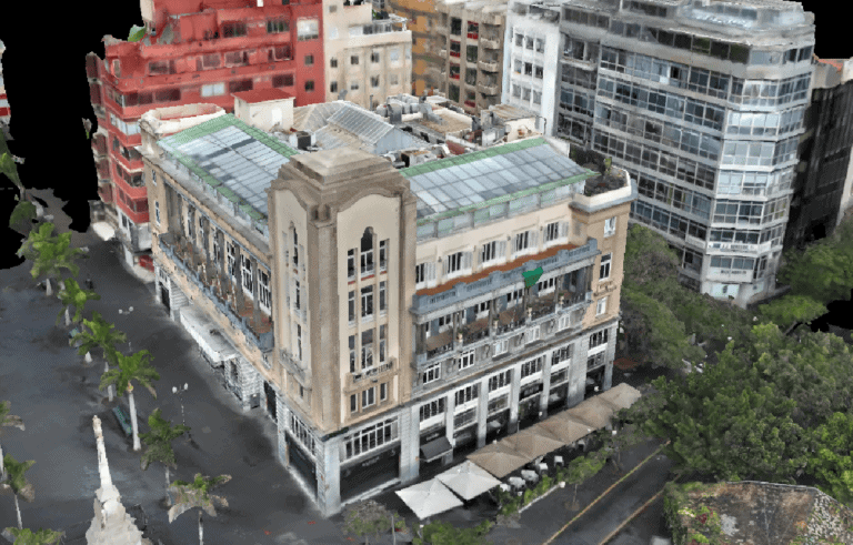
Círculo de la Amistad | BeeDron Record
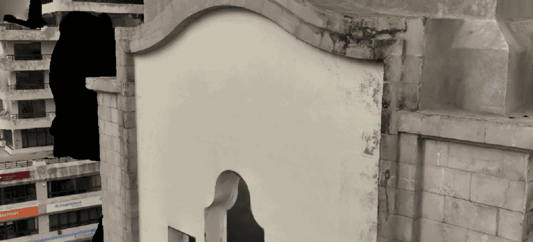
Film set | BeeDrone Record

Real-world cases of set digitalisation in the industry

  • Society of the Snow (2024) – Aerial photogrammetry in the Andes
    Bayona used drones to capture images and create a realistic 3D environment without moving the crew.

Want to know more about the filming of Society of the Snow? Click here.

  • Big Little Lies / Sharp Objects (HBO) – Digital sets based on photogrammetry
    Real locations scanned for integration in post-production, improving logistics and visual control.

  • MYND Workshop – 3D scanning with LIDAR for VFX
    Ultra-detailed models for virtual simulations, effects planning and immersive cinema.

Real-world applications in audiovisual production

Having a 3D model of the set provides a real competitive advantage to the various production departments:
DepartmentApplication of the 3D digital model
DirectionVisualisation of scenes and narrative blocks
PhotographyTesting of framing, camera paths, lighting control
ArtSet design based on the real space
ProductionLogistical and technical planning
VFXReal references for digital effects
This allows for informed decision-making from the initial stages of the project, saving time, avoiding mistakes and anticipating both technical and artistic needs.

In the context of virtual production and the metaverse, set digitalisation with drones and the creation of photorealistic digital twins are becoming even more significant.
Some companies are already using advanced techniques, including aerial photogrammetry with drones and ground-level data capture, to create accurate virtual replicas of physical spaces. These detailed and precise 3D models are essential for delivering immersive and authentic experiences in virtual environments, with applications in fields such as entertainment, education, cultural heritage preservation and virtual commerce.

Which drone should I choose?

The choice of the ideal drone for an audiovisual production depends on various technical factors, such as payload capacity, flight time, compatibility with different cameras and sensors, expected weather conditions and the planned flight zone.
Cinematographic cameras can be mounted on drones to ensure visual consistency within the production, or systems with integrated cameras can be used – these have also seen significant improvements in quality.
Drones can also offer 3D solutions through image capture software, generating point clouds for the creation of virtual environments.

Formats and compatibility

  • FBX, OBJ, Alembic, compatible with Maya, Blender, Unreal Engine.
    USDZ, glTF for virtual environments or VR.
    LAS, E57 for technical and BIM use.

Key tools for set digitalisation

  • Pix4D – Leading software for 3D reconstruction from images.
  • OpenDroneMap – Open-source option ideal for tight budgets.
  • PhotoModeler – Versatile tool for small and quick set captures.
  • Unreal Engine – Engine for scene simulation, camera tracking and virtual previsualisation.

Why the Canary Islands and why BeeDroneRecord

The Canary Islands have become one of the top destinations for international audiovisual production.
Their diverse landscapes, exceptional natural light and favourable tax conditions mean that more and more projects are choosing this archipelago as a filming location.

In this context, having a local partner who understands the unique characteristics of the region and the sector is crucial. At BeeDroneRecord, we offer specialised services in set digitalisation with drones, tailored to the specific needs of each production. From flight planning to the delivery of the 3D model, our team supports production companies with a professional, approachable and solution-focused approach.

Our experience includes collaborations with both national and international production companies, working to the high standards required by the film and television industry. In addition, our knowledge of the legal framework and ability to manage permits in protected areas or public spaces makes BeeDroneRecord a strategic partner for shoots that require agility and compliance.

Digitalisation of the Casino of Santa Cruz de Tenerife | BeeDrone Record

Conclusion: Digitise to make better decisions

In conclusion, digitising the film set with drones is an essential tool in the audiovisual pre-production phase.
It enables more efficient planning, reduces unexpected issues, improves coordination between departments and helps make informed decisions. For production companies looking to optimise resources and raise the quality of their projects, this technology represents an indispensable ally.

Want to assess whether digitising your set could optimise your next production in the Canary Islands?
At BeeDroneRecord, we offer no-obligation advice. Write to us and we’ll help you visualise your shoot from the air, even before the crew sets foot on location.

Drone photogrammetry | BeeDrone Record

Contact

We’ll provide you with a personalised quote within just a few hours.

Please enable JavaScript in your browser to complete this form.
Nombre y Apellidos
Casillas de verificación